When we woke up this morning the temperature was in the 30's . . .Brrrrrrr . . . But we were snug under the covers in our camper. (The temp went up into the 80's during the day.) Have I told you how much we LOVE our truck camper? It's the perfect size for the 2 of us and very comfortable. We can go anywhere and not worry about pulling a trailer on narrow mountain roads or finding a place to park on downtown streets. Its perfect for the way we like to travel from place to place . . . :) The only downside is the price of gas. We are averaging 9-10 mpg :(
We arrived in Taos early Sunday morning. Our first stop was Taos Pueblo, the oldest continuously inhabited community in the USA. The main adobe structures are believed to be over 1000 years old. There is no running water or electricity within their village which is considered sacred. Some families in the tribe use their property here as a second home for seasonal use and ceremonial times, while others continue to live here year round maintaining the "old ways" and preserving their traditional practices and native culture.
When we left Taos Pueblo, we drove to the Taos Historic District and found the First Presbyterian Church just in time for the 11:00am worship service. . . An answer to prayer.
We enjoyed the afternoon strolling through the Taos Plaza, admiring the adobe buildings, looking in shop windows, and learning about the life of Kit Carson at his Taos home and Museum.
Beyond Taos we crossed a suspension bridge over the narrow and VERY DEEP (650 ft) Rio Grande Gorge which suddenly appears as a jagged chasm cut from the earth. Approaching the bridge, you have no idea what you are about to cross over. Blink and you will miss it! Mark was driving and focused on the road and wouldn't have stopped if I hadn't glanced out the window to see what was under the bridge. He was amazed that he would have missed it! Our pictures don't do it justice.
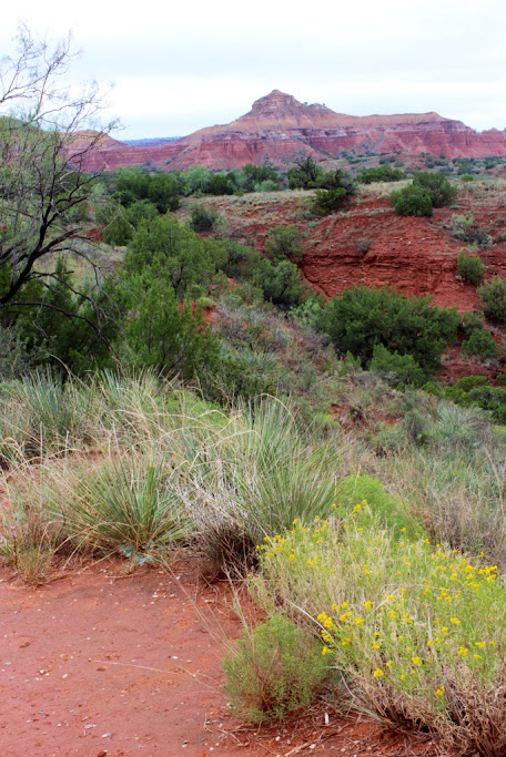
We left Hwy 64 at Tierra Amarilla to head south on Scenic Route 84 towards Santa Fe. We were concerned about finding a good place to stop for the night and happened upon Echo Amphitheater. It's like a huge outdoor bandshell carved naturally out of the cliffside. It was a GORGEOUS spot in the middle of nowhere with a paved trail, restrooms and campsites. We were the only campers and it was a peaceful, beautiful evening. Very dark, except for a myriad of stars when the sun went down.
Tomorrow we are heading to Sante Fe.
Tuesday, September 18, 2012
Sunday, September 16, 2012
Dinosaur Footprints!
It's Saturday already! Last night we had a great campsite on a cliff overlooking the lake at Clayton Lake State Park in New Mexico. The temperature was cool again and the campground peaceful with only a couple other campers. In the afternoon we took a short hike in the park to see fossilized dinosaur footprints imbedded in the sandstone. We were able to view the footprints from a raised walkway that gives access to a small section of the two-acres where they were discovered in 1982.
We woke up this morning to a beautiful blue sky and temperatures in the upper 40's, by the afternoon it was in the 70's. After we left the park we passed a couple of small herds of pronghorn antelope grazing on the prairie. They are the fastest animal in the Western Hemisphere and can run up to 70 miles an hour.
We are heading west on Highway 64 which is a route we are following that spans all of the northern most part of New Mexico. It is one of the 120 featured routes in our Reader's Digest book "The Most Scenic Drives in America".
At Capulin Volcano National Monument, we drove to the top of the conical cinder cone which rises 1,300 feet above the plains (8,182 ft above sea level), then hiked the Crater Rim Trail. We went very slowly on the 2 mile drive up Capulin Volcano since the narrow two-lane road cut out of the mountainside had a steep drop off on the outside and a vertical rock wall on the inside. You can see across the plains for miles and miles and the view includes other, more eroded, extinct volcanoes and cinder cones. Mark also hiked the short Crater Vent Trail which descends into the bottom of the crater, the plugged vent of Capulin Volcano. I stayed at the trailhead and took his picture down in the crater.
As we continued west, Hwy 64 winds through Cimarron Canyon State Park. The pretty, narrow canyon is shaded with abundant Blue Spruce and the Cimarron River can be spotted through the trees running along the roadway. We detoured off 64 on 38 and passed through the Red River ski resort on Wheeler Peak, before stopping for the night in the Fawn Lakes campground in the Carson National Forest.
Next stop Taos, New Mexico!
![]() |
Walkway among the dinosaur tracks |
![]() |
Reflections on Clayton Lake |
We are heading west on Highway 64 which is a route we are following that spans all of the northern most part of New Mexico. It is one of the 120 featured routes in our Reader's Digest book "The Most Scenic Drives in America".
At Capulin Volcano National Monument, we drove to the top of the conical cinder cone which rises 1,300 feet above the plains (8,182 ft above sea level), then hiked the Crater Rim Trail. We went very slowly on the 2 mile drive up Capulin Volcano since the narrow two-lane road cut out of the mountainside had a steep drop off on the outside and a vertical rock wall on the inside. You can see across the plains for miles and miles and the view includes other, more eroded, extinct volcanoes and cinder cones. Mark also hiked the short Crater Vent Trail which descends into the bottom of the crater, the plugged vent of Capulin Volcano. I stayed at the trailhead and took his picture down in the crater.
![]() |
Capulin Volcano |
![]() |
The plugged vent in the crater |
![]() |
Looking down from the Crater Rim Trail to the parking lot near the top of the volcano and the surrounding countryside far, far below. |
![]() |
View from the top of the volcano. |
![]() |
Cimarron Canyon |
![]() |
Pretty horses along the highway. |
Next stop Taos, New Mexico!
Friday, September 14, 2012
Palo Duro Canyon State Park in the Texas Panhandle
We spent our third night in a row in a Walmart parking lot (Pontiac Illinois, Joplin Missouri, Amarillo Texas:) and awoke to a cold, rainy day this morning. The Texans are all happy for the rain and a break from the heat:)
We drove to Palo Duro Canyon which is the second largest canyon in America (120 miles long and 800 feet deep) and known as the "Grand Canyon of Texas". We registered for a campsite tonight with electricity, water and SHOWERS. WooHoo!!
We spent the day driving around the canyon and hiking on the Lighthouse Trail. During rains, Palo Duro Canyon is subject to dangerous flash flooding and there are 6 posted areas along the park road with warnings to monitor the depth gauges and not cross if the water exceeds 6 inches. One section of the road was closed today because of water and there were several spots where the water had receded but obviously crossed the road overnight during the heavier rains.
There are also signs posted at the trailheads (along with large thermometers) to warn of the dangers of excessive heat when hiking in the park. It was fortunate for us that the rain and overcast skies had brought us cooler weather for hiking, although the trails were slick in many areas with slippery, "gooshy" red clay.
Although we had to be very careful to keep our footing and the heavy mud accumulated on our shoes, neither of us ended up on our behinds in the mud, despite a couple of close calls:) The moisture also seemed to accentuate the bright reds, oranges and greens of the surrounding landscape. Very Beautiful.
The Lighthouse Trail, which is considered moderate in difficulty, leads to a formation created by erosion called the "Lighthouse" which is 310 feet high and designated a National Natural Landmark. We attempted to hike to it (5.75 miles round trip/ 3-4 hours), but after an hour in we reached a spot that was steep and very slippery with no apparent way around it. I decided that was a good point to turn around because I had no desire to body surf down the incline in the oozy mud! We were able to see the "Lighthouse" from afar, but I didn't have the telephoto camera lens with me to get a better photo. It looked pretty cool through Mark's binoculars:)
![]() |
You can see the "Lighthouse" formation in the distance. |
Thursday, September 13, 2012
Route 66
Commissioned in 1926, Route 66, the "Main Street of America" was the first national highway to cross the country 2,448 miles from Chicago in the east to California in the west winding through Illinois, Missouri, Kansas, Oklahoma, Texas, New Mexico, Arizona and California. Route 66 doesn't appear on modern maps anymore (it has been replaced by five interstate highways I-55, I-44, I-40, I-15 and I-10), but you can still find parts of the historic road to drive these days if you do your homework. Much of it has been incorporated into the current system of roads traversing small American towns. Some sections have completely disappeared, and some parts are abandoned, disintegrating and overgrown with weeds. We found that it can at times be a challenge to find some of the existing historic sections, but discovered a few gems along the way when we ventured off the main highway in search of them. Historic restored gas stations, rustic bridges and an interesting Route 66 Museum in Clinton, Oklahoma were some of our successful finds:)
Today (9/13) is a cold, rainy day in Amarillo,TX. We spent the night at a Walmart and are heading to nearby Palo Duro Canyon State Park this morning. We hope their campground has water, electricity and showers:)
![]() |
Soulsby Shell Station built in 1926 in Mt Olive, Illinois. Oldest one still standing on Rte 66. |
![]() |
"World's Largest"rocking chair - Cuba, Missouri |
![]() |
Devil's Elbow |
![]() |
Oklahoma Rte 66 Museum - Worth the stop! |
Today (9/13) is a cold, rainy day in Amarillo,TX. We spent the night at a Walmart and are heading to nearby Palo Duro Canyon State Park this morning. We hope their campground has water, electricity and showers:)
Tuesday, September 11, 2012
We're Off!
Our journey began yesterday about 1:30pm from the Grand Haven library where we stopped to drop off a book I was cramming to finish before we left. We had planned to leave early in the morning but were delayed due to a rescheduled dental appointment.
We stopped at the Cabela's in Hammond, Illinois to purchase a Mace Pepper Gun and cartridges to use for self- defense (if we ever meet an angry bear or "bad guy" out in the middle of nowhere in the remote spots we get ourselves into:) It was the first time I've ever been in a Cabela's. It's a BIG place! Mark was in hunter mode, in a hurry to locate and bag the prize catch. I, on the other hand, was ambling along, wide-eyed, taking in all the animals (really cool stuffed animals . . . everywhere). There was even a bear killing a deer . . . I didn't know bears attack deer . . .
Near Dwight, Illinois we took our first jog off the highway onto a portion of Historical Route 66 and stopped at an old restored 1933 Texaco Gas Station that's listed on the National register as Ambler's Texaco. There was another couple there also taking pictures.
A little further on in Odell, Illinois we found another registered 1932 Standard Station and ran into the same couple again. We found out they are from Connecticut and are exploring Route 66 all the way to Las Vegas to visit their son. I wonder if we will run into them again.
After only 249 miles we found the Walmart in Pontiac, Illinois and decided to stop for the night at 8:30/7:30 their time, so Mark could rest his eyes. His right eye was blurry and hurting. Since his Lasik surgery in August he still has problems with it as the day progresses and his eyes get tired. I couldn't take over driving because I had one of my too frequent (lately) headaches.
We had a cozy, comfy night in the Walmart parking lot:)
We stopped at the Cabela's in Hammond, Illinois to purchase a Mace Pepper Gun and cartridges to use for self- defense (if we ever meet an angry bear or "bad guy" out in the middle of nowhere in the remote spots we get ourselves into:) It was the first time I've ever been in a Cabela's. It's a BIG place! Mark was in hunter mode, in a hurry to locate and bag the prize catch. I, on the other hand, was ambling along, wide-eyed, taking in all the animals (really cool stuffed animals . . . everywhere). There was even a bear killing a deer . . . I didn't know bears attack deer . . .
Near Dwight, Illinois we took our first jog off the highway onto a portion of Historical Route 66 and stopped at an old restored 1933 Texaco Gas Station that's listed on the National register as Ambler's Texaco. There was another couple there also taking pictures.
1933 Texaco on Historic Rte 66 in Dwight, Illinois |
![]() |
1932 Standard Station (listed on the National Register) |
We had a cozy, comfy night in the Walmart parking lot:)
Subscribe to:
Posts (Atom)